🥾 16 Best Hikes in Zion National Park (With Trail Maps)
Zion National Park is home to soaring cliffs, lush canyons, and one of the most diverse trail systems in the Southwest. Whether you’re a first-time visitor or a seasoned hiker, these 16 trails offer something for everyone.
1. The Narrows
Hike directly through the Virgin River between towering canyon walls. A refreshing and iconic Zion experience.
• Difficulty: Moderate–Strenuous
• Distance: 9.4 mi (round trip)
• Estimated Time: 6–8 hrs
• Elevation Gain: 334 ft
• Trail Map: https://www.nps.gov/zion/planyourvisit/thenarrows.htm
2. Angels Landing
A heart-pounding climb with chains and exposed cliffs, leading to one of the most thrilling viewpoints in the U.S.
• Difficulty: Strenuous
• Distance: 5.4 mi (round trip)
• Estimated Time: 4–5 hrs
• Elevation Gain: 1,488 ft
• Trail Map: https://www.nps.gov/zion/planyourvisit/angels-landing-hiking-permits.htm
3. Canyon Overlook
• Difficulty: Easy
• Distance: 1 mi (round trip)
• Estimated Time: 30–60 mins
• Elevation Gain: 163 ft
• Trail Map:https://www.nps.gov/thingstodo/hike-canyon-overlook.htm
4. Timber Creek Overlook
A peaceful trail in Kolob Canyons with sweeping views of cliffs, ridges, and Pine Valley Mountains.
• Difficulty: Easy
• Distance: 1 mi (round trip)
• Estimated Time: 30 mins
• Elevation Gain: 100 ft
• Trail Map: https://www.nps.gov/thingstodo/zion-kolob-canyons.htm
6. La Verkin Creek
• Difficulty: Strenuous
• Distance: 14 mi (round trip)
• Estimated Time: 7–10 hrs or overnight
• Elevation Gain: 1,100 ft
• Trail Map: https://www.nps.gov/zion/planyourvisit/laverkin-creek-trail.htm
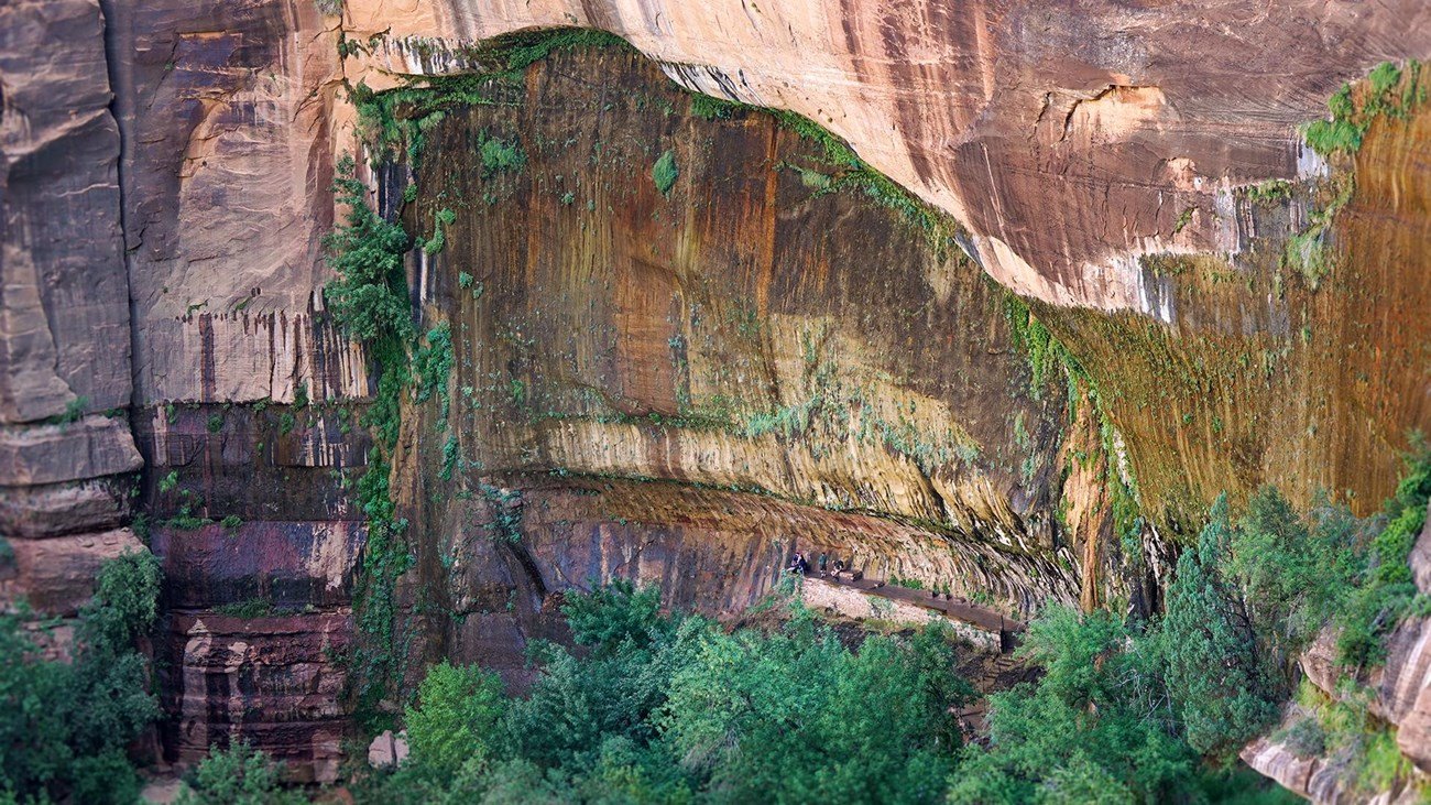
7. Weeping Rock CURRENTLY CLOSED
A very short but scenic trail to a dripping alcove with lush hanging gardens. Great for families.
• Difficulty: Easy
• Distance: 0.4 mi (round trip)
• Estimated Time: 15 mins
• Elevation Gain: 98 ft
• Trail Map: https://www.nps.gov/thingstodo/zion-weeping-rock.htm
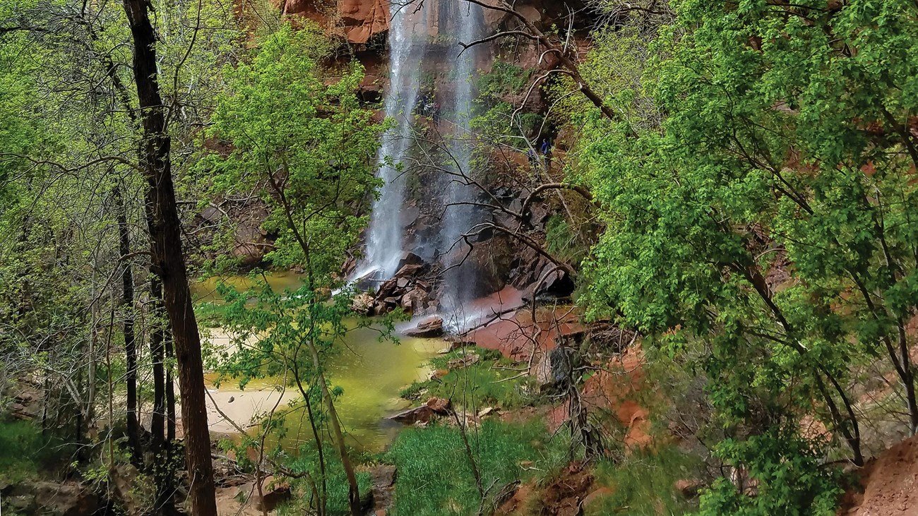
8. Lower Emerald Pool
• Difficulty: Easy
• Distance: 1.2 mi (round trip)
• Estimated Time: 30–45 mins
• Elevation Gain: 69 ft
• Trail Map: https://www.nps.gov/thingstodo/zion-emerald-pools.htm
9. Hop Valley Trail
Quiet and wide-open, this trail showcases Zion’s pastoral side with red cliffs and open meadows.
• Difficulty: Moderate
• Distance: 6.6 mi (one way)
• Estimated Time: 3–5 hrs
• Elevation Gain: 500 ft
• Trail Map: https://www.alltrails.com/trail/us/utah/hop-valley-trail
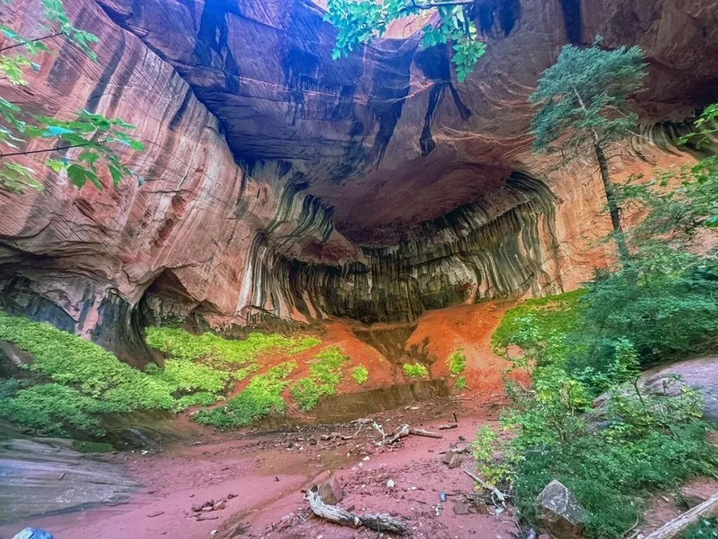
10. Taylor Creek Trail
A delightful hike along a stream in Kolob Canyons, ending at a dramatic double-arch alcove.
• Difficulty: Moderate
• Distance: 5 mi (round trip)
• Estimated Time: 2–3 hrs
• Elevation Gain: 450 ft
• Trail Map: https://www.nps.gov/thingstodo/zion-taylor-creek.htm
11. Lava Point Overlook
Short walk to a stunning overlook at 7,890 ft—Zion’s highest viewpoint. Great for a quick stop.
• Difficulty: Easy
• Distance: 0.3 mi (round trip)
• Estimated Time: 15 mins
• Elevation Gain: Minimal
• Trail Map: https://www.nps.gov/thingstodo/zion-lava-point.htm
12. Hidden Canyon
A slot canyon tucked into the cliffside. Features chains and steep drop-offs—adventurous and scenic.
• Difficulty: Strenuous
• Distance: 3.3 mi (round trip)
• Estimated Time: 2–3 hrs
• Elevation Gain: 940 ft
• Trail Map: https://www.alltrails.com/trail/us/utah/hidden-canyon-trail--2
13. The Subway (Bottom-Up)
One of Zion’s most iconic technical hikes. Scramble through a sculpted canyon to reach the famous 'Subway' tube.
• Difficulty: Strenuous
• Distance: 9 mi (round trip)
• Estimated Time: 6–8 hrs
• Elevation Gain: 1,300 ft
• Trail Map: https://www.nps.gov/zion/planyourvisit/thesubway.htm
14. West Rim Trail (Lava Point to Grotto)
A full-day (or overnight) hike through high country and epic canyon views—includes top-down access to Angels Landing.
• Difficulty: Strenuous
• Distance: 14.5 mi (one way)
• Estimated Time: 8–12 hrs
• Elevation Gain: 1,600 ft descent
• Trail Map: https://www.nps.gov/thingstodo/zion-west-rim-trail.htm
15. Pa’rus Trail
A flat, paved trail along the Virgin River—perfect for a peaceful walk, biking, or wheelchair accessibility.
• Difficulty: Easy
• Distance: 3.5 mi (round trip)
• Estimated Time: 1–2 hrs
• Elevation Gain: 50 ft
• Trail Map: https://www.nps.gov/thingstodo/zion-parus-trail.htm
16. Pine Creek Gorge Slot Canyon
A short but technical canyoneering route. Requires ropes and gear—best for experienced adventurers.
• Difficulty: Strenuous
• Distance: 1.5 mi (technical route)
• Estimated Time: 2–3 hrs
• Elevation Gain: Varies
• Trail Map: https://www.alltrails.com/trail/us/utah/pine-creek-canyon--2